Today was all about wandering and looking. We headed off for our local train station, only to find that the trains weren’t running (we think it was something to do with a death at a station down the line). So we used Apple’s new transit maps to catch two buses to Potsdamer Platz, where we had finished our wandering the previous day.
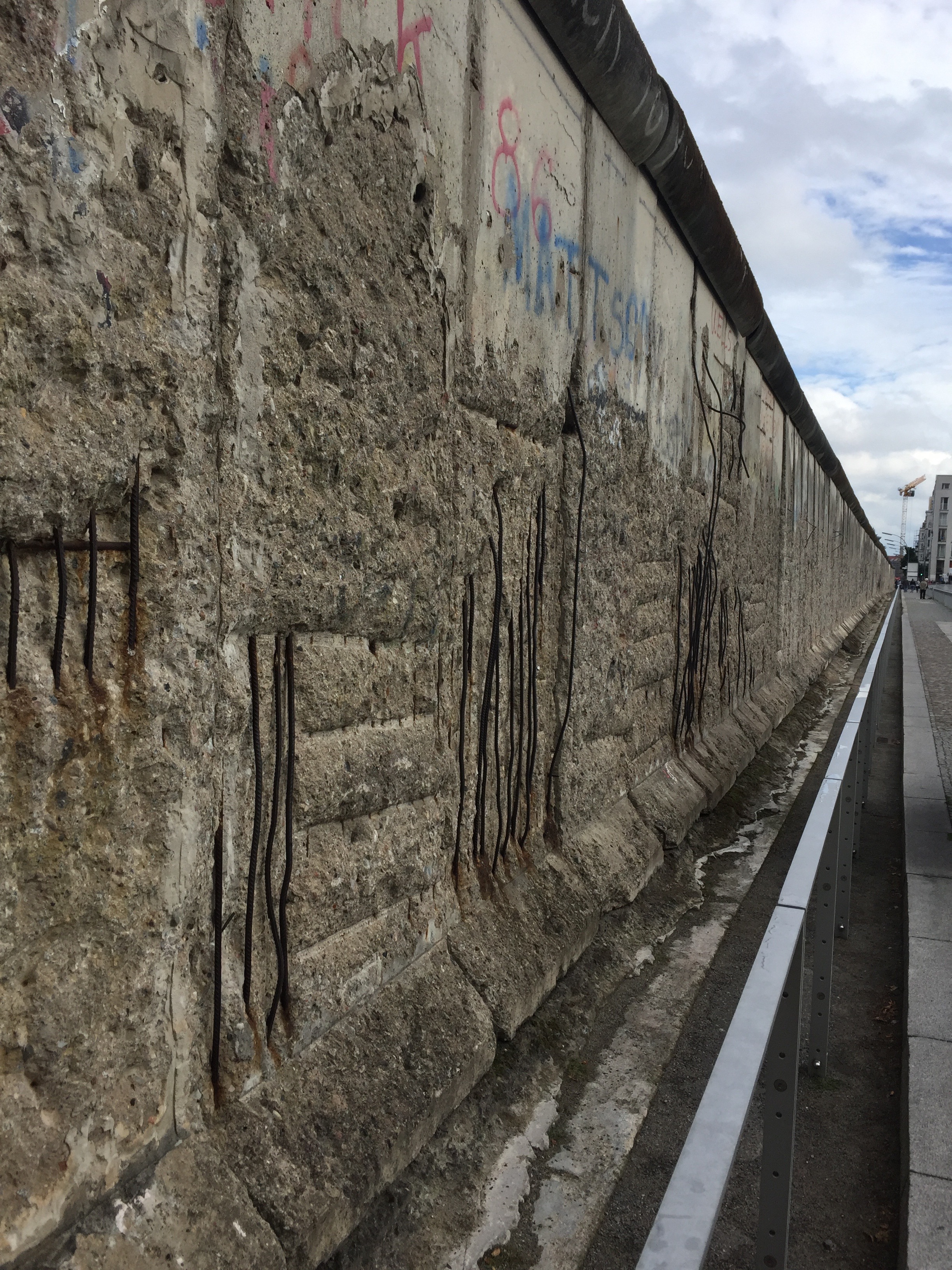
We wandered along the remnants of the wall in the direction of Checkpoint Charlie. We stopped about half way at the site of a preserved section of wall that also contains a really detailed history of how Berlin was involved in WWII – with lots of stories about the people and places – both Jews and Nazis. The display is called the Topography of Terror. It started out as a temporary installation and is now permanent.
Checkpoint Charlie is one of three checkpoints installed in the American sector of West Berlin after the wall was put up in 1961 – i.e. Alpha, Bravo, Charlie – and has become something of a tourist attraction.

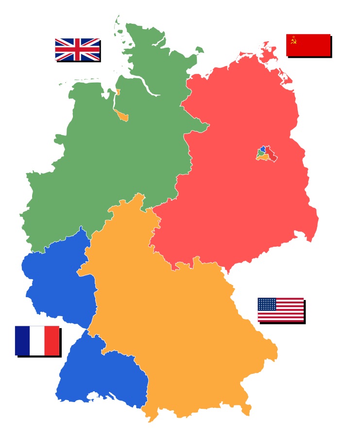
The East / West divide is the weirdest thing, and something I didn’t fully understand before I got here. I had a vague idea that the Berlin Wall divided East and West Germany, but in fact, the wall contained the city of West Berlin within East Germany. The city was divided in two, and the West half was entirely contained within East Germany – you had to fly or catch a train to get from West Berlin to the rest of West Germany.
The wall was put up by the East years after the East/West split happened to prevent defections – over 3 million people left East Germany via West Berlin before the wall was erected overnight in 1961.
It seems like a wacky idea to me to divide the city in half like that – if you lived in one half and worked in the other – too bad. If your parents lived on the other side, also too bad. What if you didn’t want to be a communist? To bad – if you live on the communist side of Berlin, you’re a communist now.
And then there is the fact that West Berlin (and West Germany) was actually three sectors – French, English and American. Immediately following the war, and after they’d agreed on the split with Russia, the Allies divided the West part of the city and country up and each nation ran their own bit of it. So when you think about it, ‘Germany’ after the war was actually a coalition country made up of France, Great Britain, USA and Russia.

And this split happened because the Russians managed to make it to Berlin first as the war was ending. Politics is strange, to say the least.
Anyway, back to the wandering. We meandered our way through the city, past the Berlin Cathedral, Museum Island and various other points of interest (we were using a very helpful and informative audio walking tour). We paused at the Berlin Museum to learn more about the rest of Germany’s history. The museum has an excellent display of history beginning around 200-300BC and going right through to reunification in 1990. Stephen was in shield and armour heaven. I liked the maps – Germany has changed its borders a lot in the past 1000 years!
This map particularly amuses me – an East German map of Berlin. The bit in the middle is West Berlin.

We stopped briefly for food then rounded out our walking tour at the Alexander Platz – a lovely square that was originally in East Germany, and contains the Fernsehturm TV tower. This is the second-tallest building in Europe (some other TV tower in Britain is taller).
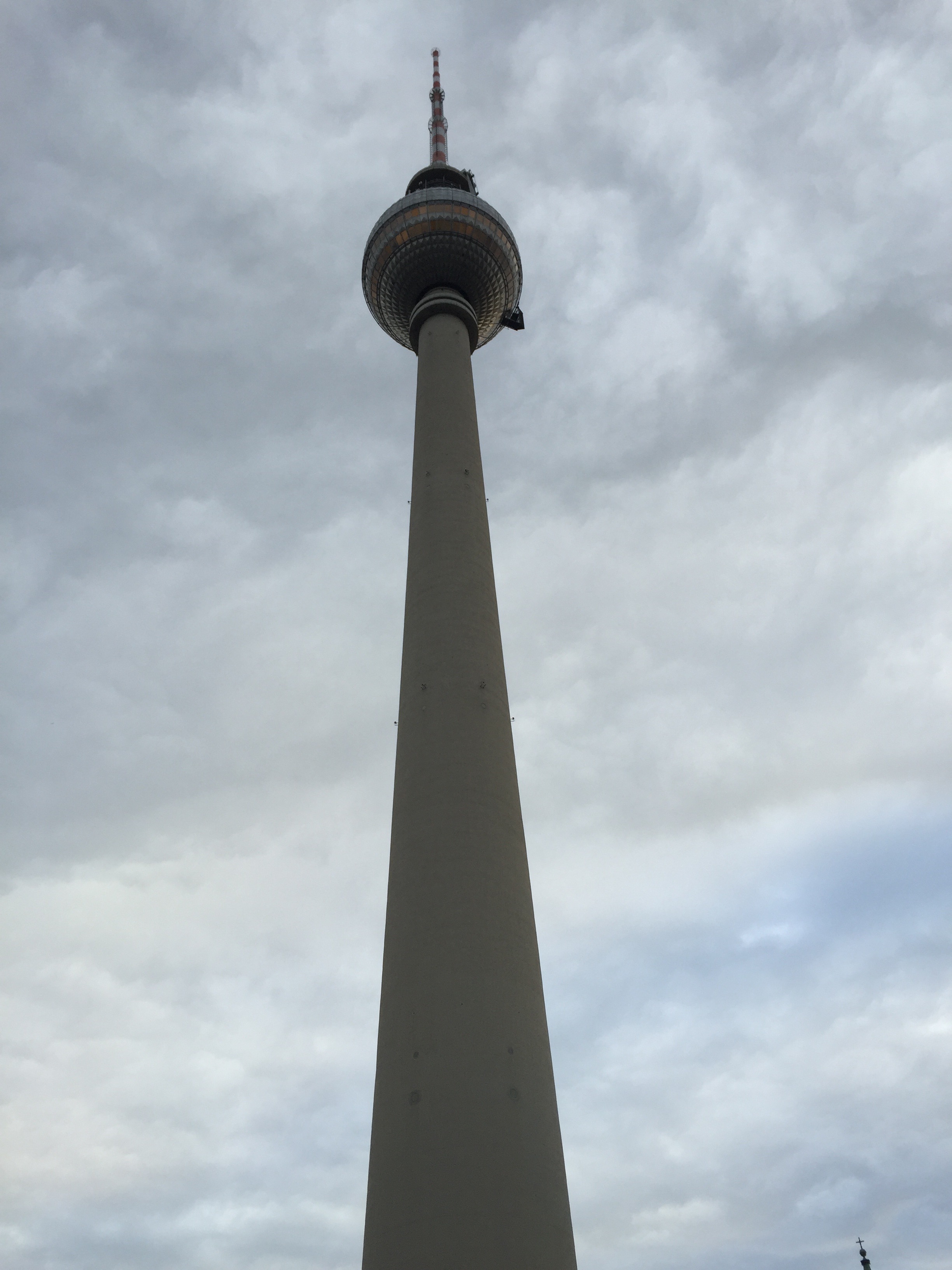
1000 steps from bottom to top – but there is an elevator you can catch up to the revolving restaurant in the bubble.
Then on to more serious things – a visit to the Apple store – where there were people camping out waiting for the iPhone 6S – due to be released in two days. They were actual camping, with tents. We also found a Haagen Dazs across the road. Perfection.
After a quick train ride we were back at base camp – a late night for us tonight, we didn’t get home until about 9pm. Frankfurt tomorrow!
